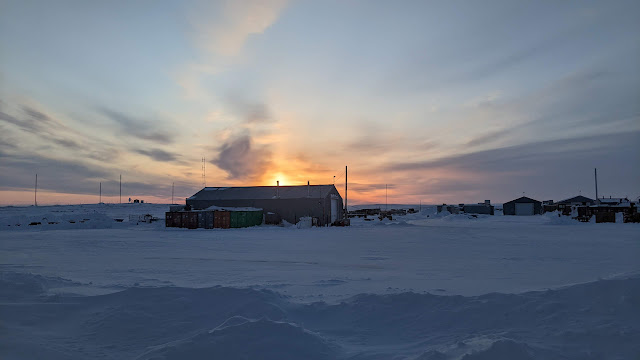
Weather Day at Resolute Bay #3
Day 16 Weather Day #3 in Resolute Bay.
As we sit here contemplating the ups and downs of airborne remote sensing surveys, there was an opportunity to take a few shots of the industrial complex. The photo above was taken at about 11 pm. The sun sets fuly at around 12 midnight. It rises at 2:30 am. It is not fully dark in between either.
The PSCP is an NRCan facility. Therefore, they keep the roads very clear and as a result, create 5-6 m snowbanks from the snow clearance operations in some places. The location of the complex means that blowing snow accumulates readily in some large drifts.
Resolute Bay located in the south of Cornwallis Island (left). The airport and community are located in the right hand map. To the south and west is the Northwest Passage from where winds will blow snow around the airport during the winter.
Snow banks from road clearing / ploughing
Snowdrifts around the windows.
Tomorrow: fly day....maybe!


Comments
Post a Comment