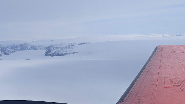
Posts

Devon Ice Cap

Image
  Day 19. Devon Ice Cap and Haughton Crater. This was the last day of flying. The weather tomorrow looks not so good. And we will have to de-install our gear so that the remaining group can continue onwards to Eureka and Station Nord.  The weather looked a little iffy the night before but on Saturday morning the weather looked good so the decision was made to give it a go. In the end, the flight conditions were great and we were able to make a successful transit to Devon and then up and over the ice cap, starting at a 1000 m agl from the north west to the south and then following the previous Cryosat transect from the Ice cap's apex to the southern margin. The pilots tracked the line perfectly while attempting to keep the height above ground level constant - no mean feat given the convex surface of the glacier.   Devon Ice Cap flight track. The eastern track is from north to south and was for CryoSAR acquisitions at 1000 m agl and the western track was from south to north for the A

Pond Inlet - worth the wait

Image
  Day 18. Pond Inlet SmartICE survey. Having waited at the PSCP fcilty for four days, on Friday we were able to get out and fly. Pond inlet is about 600 km from Resolute Bay, or just over two hours of flying at best speed. The goal was to fly the SAR at our normal 1000 m above the sea ice, and then fly a low survey with the snow radar and the lidar at 500m asl. The flight there was nothing short of spectacular. The flight took us along the Northwest Passage and then over the northern coast and northern tip of Baffin Island (Canada's largest island) - the Brodeur Peninsula, then over Arctic bay, before descending into Pond Inlet which is the channel between Baffin and Bylot Islands. This takes in some text-book high Arctic scenery which is absolutely stunning.    Northern coastline of Brodeur Peninsula from over the NW Passage   Northern coast of Brodeur Peninsula. The geological strata alon the slopes are a stunning feature of this landscape   Northern edge of Brodeur Peninsula   S

Weather Day at Resolute Bay #4

Image
  Day 17. Weather Day #4 in Resolute Bay. Today was another no fly day :( The weather has not been kind. The issue is that around Resolute Bay the winds have been stronger than desired. The plan is to survey at Devon Ice Cap (1.5 hours flying away) and Pond Inlet (2 hours away). The weather at Devon has been a no-go, and while Pond has been viable, the issue has been the weather at Resolute or on the way. So we have continued to bide our time. Jeff has been out and about taking some landscape photos (see above), and below, we installed a corner reflector along the road form the airport, and we engaged with some training of the equipment with our new team member Nils, who joined us yesterday in Resolute, form AWI.   Self Portraits [Left] Claude Monet with a Beret. [Right] Jeff with a Beannie.   View across the tundra on Cornwallis Island.   Polar 5 is ready for action whenever we get the green light. Next to it is definitely a Twin Otter (i.e. not a Dornier 228).   Installing a corner

Weather Day at Resolute Bay #3

Image
Day 16 Weather Day #3 in Resolute Bay. As we sit here contemplating the ups and downs of airborne remote sensing surveys, there was an opportunity to take a few shots of the industrial complex. The photo above was taken at about 11 pm. The sun sets fuly at around 12 midnight. It rises at 2:30 am. It is not fully dark in between either. The PSCP is an NRCan facility. Therefore, they keep the roads very clear and as a result, create 5-6 m snowbanks from the snow clearance operations in some places. The location of the complex means that blowing snow accumulates readily in some large drifts. Resolute Bay located in the south of Cornwallis Island (left). The airport and community are located in the right hand map. To the south and west is the Northwest Passage from where winds will blow snow around the airport during the winter.   Snow banks from road clearing / ploughing   Snowdrifts around the windows.    Tomorrow: fly day....maybe!

Weather Day at Resolute Bay #2

Image
  Day 15. Weather day #2. Things to do at PCSP Resolute Bay while waiting for the weather to improve for flights: Have breakfast   Amazing what is available for breakfast :) Read Check Windy (weather app) Plan flight tracks for Devon Ice Cap Watch EPL soccer on TV Take photos of the changing weather (see sundogs above) Play pool Check Windy Play snooker Read a book (write this diary) Eat lunch   Jeff's lunch - there is always food available between meals Check Windy Try not to discharge too much static electricity around the building Have dinner Check Windy Tomorrow: perhaps a fly day ;)

Weather Day in Resolute Bay

Image
Day 14. Weather day in Resolute Bay - no flying. A big complex weather system has descended on us today. The difficulty is that the weather is unpredictable at the sites that we are interested in. We might be able to get to both but we would not be able to return. So it's a "sit back and wait for things to clear" day. Fingers crossed for tomorrow.

Penny Strait

Image
  Day 13. Pond Inlet , Byam Martin Channel , Penny Strait. Successful field work and airborne survey execution requires a significant amount of preparation and an ability to bring the right tool for the job at hand. And even then, one has to be prepared for the situations that arise unexpectedly and can create instant problems that need to be solved. Here are three examples from the day's activities that can perhaps illustrate this.  1. Ability to read the weather forecast. Originally, we were hoping to survey the sea ice near Pond Inlet, a community across the channel from Bylot Island and on the north coast of Baffin Island. This is where there is a significant SmartICE presence. However, Windy , our trusty weather app that uses several models for its weather forecasting was predicting high winds that would have made our surveys too difficult, especially for the EM bird which is slung below the Polar 5 at about 50 feet above the sea ice. So Plan B was to go to Byam Martin Channel