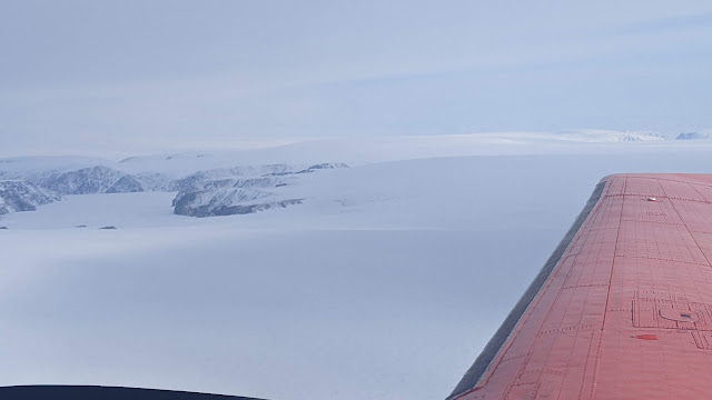
Devon Ice Cap
Day 19. Devon Ice Cap and Haughton Crater. This was the last day of flying. The weather tomorrow looks not so good. And we will have to de-install our gear so that the remaining group can continue onwards to Eureka and Station Nord.
The weather looked a little iffy the night before but on Saturday morning the weather looked good so the decision was made to give it a go. In the end, the flight conditions were great and we were able to make a successful transit to Devon and then up and over the ice cap, starting at a 1000 m agl from the north west to the south and then following the previous Cryosat transect from the Ice cap's apex to the southern margin. The pilots tracked the line perfectly while attempting to keep the height above ground level constant - no mean feat given the convex surface of the glacier.
Devon Ice Cap flight track. The eastern track is from north to south and was for CryoSAR acquisitions at 1000 m agl and the western track was from south to north for the ALS and snow radar acquisitions at 500 m agl.
Our colleagues, Dave Burgess and Brad Denielson from GSC, arrived at the field on the same day that we flew the lines so the goal is for them to make on the ground measurements to tie-in with our airborne SAR measurements. So we are fortunate to have yet another place where field measurements are made almost at the same time as our activities! Dave has been making mass balance measurements for close to 20 years on Devon (among other places) constituting a very important document record of glacier change over this time. The measurements were begun before he started so the climate record that we now have is vital for our understanding of the state of these ice cap systems.
Looking southwards across the ice cap's margin as we turn to make our first transect pass.
Looking across the edge of the ice cap
Having run the two transects, we headed west back towards Resolute Bay
View towards Sverdrup Inlet
View southwards
View southwards
View southwards
On the return leg, we took a detour over the Haughton Crater so that we cpould acquire some L-band data. This is a site that has been used as a Mars analogue environment where NASA / CSA etc have tested out technologies that could be applicable for Mars habitation. The goal was to acquire some data for colleagues at York University who are leading an L-band SAR planetary project.Flight track over the Haughton Crater
With that, we completed our surveys and headed back to Resolute Bay.
Tomorrow: deinstall and prepare for return home for Jeff and Richard. The remaining crew to head to Eureka and beyond.


.jpeg)


Comments
Post a Comment