Pond Inlet - worth the wait
Day 18. Pond Inlet SmartICE survey. Having waited at the PSCP fcilty for four days, on Friday we were able to get out and fly. Pond inlet is about 600 km from Resolute Bay, or just over two hours of flying at best speed. The goal was to fly the SAR at our normal 1000 m above the sea ice, and then fly a low survey with the snow radar and the lidar at 500m asl.
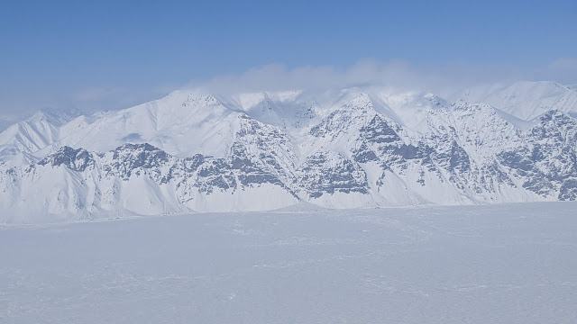
The flight there was nothing short of spectacular. The flight took us along the Northwest Passage and then over the northern coast and northern tip of Baffin Island (Canada's largest island) - the Brodeur Peninsula, then over Arctic bay, before descending into Pond Inlet which is the channel between Baffin and Bylot Islands. This takes in some text-book high Arctic scenery which is absolutely stunning.
Northern coastline of Brodeur Peninsula from over the NW Passage
Northern coast of Brodeur Peninsula. The geological strata alon the slopes are a stunning feature of this landscape
Northern edge of Brodeur Peninsula
Sea ice in the Northwest Passage.
Will the passage be open or not under a heating climate? The smart money has it on being equivocal - because the sea ice dynamics (drift, production, melt, survival) are complex in the Canadian Arctic Archipelago. The system is somewhat disconnected form the main Arctic Ocean and has its own life cycle. Likely this means that the complete opening of the NW Passage will be irregular or periodic. However, it may be that it will often be dominated by first year ice which may be more navigable in some years than others.The trick will be to predict when it will be open/accessible and when it will not. This is an active topic of research.
Icebergs in the Northwest Passage - probably drifted in from Greenland.
Then we descended into Pond Inlet. The hamlet of Pond Inlet is small (1555 people at the 2021 census count). It is perched on the northern coast of Baffin Island.
Descent into the northern channel of Pond Inlet
The survey design for Pond Inlet is the hockey stick format. SmartICE surveys were conducted on the ice in the days leading up to our flight. These are long-ish survey lines that take about 12 mins each. We collected about 2 Tb of raw data which will yield another 2 Tb of fully processed data, eventually.
Survey flight tracks for Pond Inlet. The circles indicate the locations of the SmartICE measurement sites
View from the Polar 5 of a SmartICE team on the ice. See if you can spot them.
A couple of Pond Inlet photos from Jeff.
The scenery around Pond Inlet is spectacular. No doubt about it. And a very cool video from Jeff of the southern coastal mountains of Bylot Island should help to cement that view.
Jeff's video footage of a Polar 5 banked turn with the Bylot Island mountains in full splendour.
After a very successful 6 hour flight survey, we returned to Resolute Bay to plan the next day.


.jpeg)


Comments
Post a Comment