Posts

Weather Day at Resolute Bay #4

Image
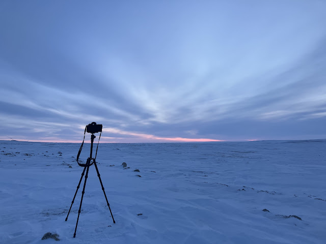
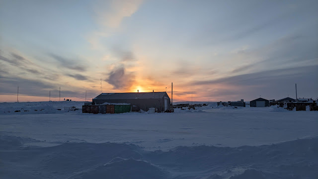
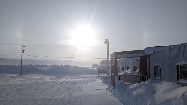
  Day 17. Weather Day #4 in Resolute Bay. Today was another no fly day :( The weather has not been kind. The issue is that around Resolute Bay the winds have been stronger than desired. The plan is to survey at Devon Ice Cap (1.5 hours flying away) and Pond Inlet (2 hours away). The weather at Devon has been a no-go, and while Pond has been viable, the issue has been the weather at Resolute or on the way. So we have continued to bide our time. Jeff has been out and about taking some landscape photos (see above), and below, we installed a corner reflector along the road form the airport, and we engaged with some training of the equipment with our new team member Nils, who joined us yesterday in Resolute, form AWI.   Self Portraits [Left] Claude Monet with a Beret. [Right] Jeff with a Beannie.   View across the tundra on Cornwallis Island.   Polar 5 is ready for action whenever we get the green light. Next to it is definitely a Twin Otter (i.e. not a Dornier 228). ...

Weather Day at Resolute Bay #3

Image
Day 16 Weather Day #3 in Resolute Bay. As we sit here contemplating the ups and downs of airborne remote sensing surveys, there was an opportunity to take a few shots of the industrial complex. The photo above was taken at about 11 pm. The sun sets fuly at around 12 midnight. It rises at 2:30 am. It is not fully dark in between either. The PSCP is an NRCan facility. Therefore, they keep the roads very clear and as a result, create 5-6 m snowbanks from the snow clearance operations in some places. The location of the complex means that blowing snow accumulates readily in some large drifts. Resolute Bay located in the south of Cornwallis Island (left). The airport and community are located in the right hand map. To the south and west is the Northwest Passage from where winds will blow snow around the airport during the winter.   Snow banks from road clearing / ploughing   Snowdrifts around the windows.    Tomorrow: fly day....maybe!

Weather Day at Resolute Bay #2

Image
  Day 15. Weather day #2. Things to do at PCSP Resolute Bay while waiting for the weather to improve for flights: Have breakfast   Amazing what is available for breakfast :) Read Check Windy (weather app) Plan flight tracks for Devon Ice Cap Watch EPL soccer on TV Take photos of the changing weather (see sundogs above) Play pool Check Windy Play snooker Read a book (write this diary) Eat lunch   Jeff's lunch - there is always food available between meals Check Windy Try not to discharge too much static electricity around the building Have dinner Check Windy Tomorrow: perhaps a fly day ;)

Weather Day in Resolute Bay

Image
Day 14. Weather day in Resolute Bay - no flying. A big complex weather system has descended on us today. The difficulty is that the weather is unpredictable at the sites that we are interested in. We might be able to get to both but we would not be able to return. So it's a "sit back and wait for things to clear" day. Fingers crossed for tomorrow.

Penny Strait

Image
  Day 13. Pond Inlet , Byam Martin Channel , Penny Strait. Successful field work and airborne survey execution requires a significant amount of preparation and an ability to bring the right tool for the job at hand. And even then, one has to be prepared for the situations that arise unexpectedly and can create instant problems that need to be solved. Here are three examples from the day's activities that can perhaps illustrate this.  1. Ability to read the weather forecast. Originally, we were hoping to survey the sea ice near Pond Inlet, a community across the channel from Bylot Island and on the north coast of Baffin Island. This is where there is a significant SmartICE presence. However, Windy , our trusty weather app that uses several models for its weather forecasting was predicting high winds that would have made our surveys too difficult, especially for the EM bird which is slung below the Polar 5 at about 50 feet above the sea ice. So Plan B was to go to Byam Martin Ch...

Finishing up an infinished survey in CB and transitting to Resolute Bay

Image
Day 12 Terrestrial snow and CB departure. Today the weather was back on our side and we set out to complete the curtailed airborne surveys of the MOACC intensive monitoring area north of Cambridge bay. The map below shows the flight track from two days ago followed by the survey completed today. Survey coverage from Day 10.   Survey coverage from Day 12 (today) The flight over the MOACC site completed another successful terrestrial survey. We now have multiple lidar, high res digital camera, snow radar and CryoSAR observations of TVC and MOACC sites where field measurements have been ongoing, but also many EM bird acquisitions over sea ice where SmartICE has been conducting in situ surveys. This is turning out to be a super significant campaign with a large amount of surveys conducted over study sites. After we landed, the Polar 5 was packed up and readied for a transit flight from Cambridge Bay to Resolute for our next leg. Before we departed, we had a chance to show a couple of r...

A welcome break - no flying today

Image
Day 11. A weather day at Cambridge Bay (CB). Today was a welcome down day and an opportunity to catch up with a few things. It also provided an opportunity to chat with the team working on the IVORI project and on the MOACC project. We were also given a fascinating tour of the CHARS facility by Dr. David Hik, the President and CEO of the CHARS facility. First up, the CHARS building is an impressive federally funded building, about 10 years in the planning and making and a central part of Polar Knowledge Canada . It is a core part of Canada's Arctic research capacity and is home for scientists and researchers for short or longer periods of time. It has a staff complement located in CB but also in other parts of northern communities who help and assist in its operations.  The building itself is a LEED Silver designated building, no mean feat given the remoteness of the site. It facilitates research by providing infrastructure and logistical support for funded projects but it is also...