Posts

Showing posts from May, 2024

Thanks

Image
  Map of entire route. Yellow lines = commercial. Dark lines = surveys. There are many people who should be acknowledged for this team effort. Please let me know if I have missed anyone.                       PCSP, CHARS/Polar Knowledge Canada    

Homeward Bound

Image
    Team Icebird24. (from left to right) Jeff, Dwayne, Alan, Kyle, Martin Richard, Nils, Christian and Arttu   Day 20, 21, 22, 23 and 24. Preparing for, and departing from the Polar 5 and Icebird 24 campaign. Day 20 (Sunday 28th April) was a prep and packing day. First up: the corner reflector. There is always a bit of a risk when you leave gear in cold, icy and windswept landscapes for a few days (or more) that it a) blows away, b) is eaten or c) both a) and b). Luckily, the corner reflector remained intact and fcaing due west as we left it a few days before.   Jeff and Nils happy that the corner reflector remained intact. Second;: dismantling and packing up the CryoSAR hardware. This was expertly completed by Dwayne, the aircraft mechanic / engineer who pays attention to the weight and balance equation of the survey aircraft. When equipment is installed or removed, it is essential that the aircraft is complaint and correctly balanced so that there is no threat to t...

Devon Ice Cap

Image
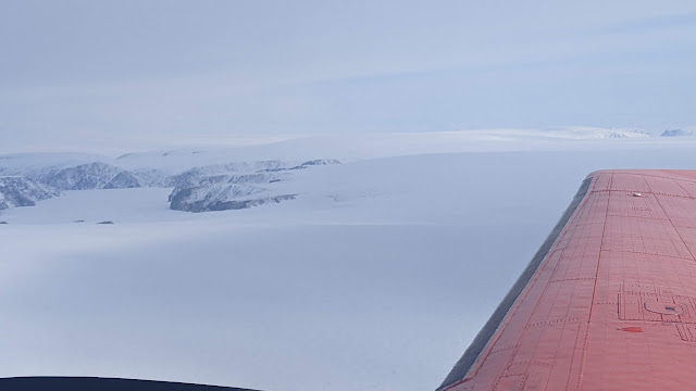
  Day 19. Devon Ice Cap and Haughton Crater. This was the last day of flying. The weather tomorrow looks not so good. And we will have to de-install our gear so that the remaining group can continue onwards to Eureka and Station Nord.  The weather looked a little iffy the night before but on Saturday morning the weather looked good so the decision was made to give it a go. In the end, the flight conditions were great and we were able to make a successful transit to Devon and then up and over the ice cap, starting at a 1000 m agl from the north west to the south and then following the previous Cryosat transect from the Ice cap's apex to the southern margin. The pilots tracked the line perfectly while attempting to keep the height above ground level constant - no mean feat given the convex surface of the glacier.   Devon Ice Cap flight track. The eastern track is from north to south and was for CryoSAR acquisitions at 1000 m agl and the western track was from south to north...